City of Buffalo, NY Map - New Century Atlas of Erie County, New York, 1909
City of Buffalo, NY Map - New Century Atlas of Erie County, New York, 1909
Couldn't load pickup availability
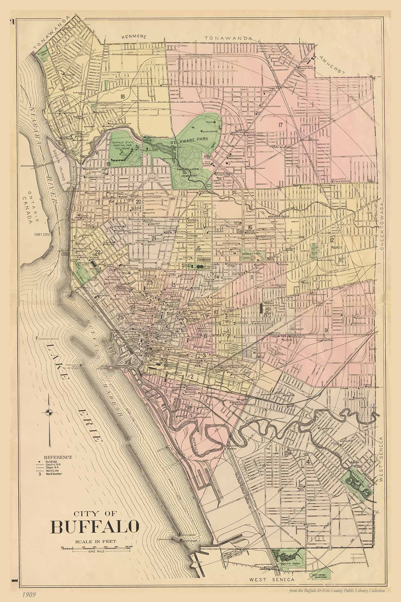
For over a dozen years the Century Map Company of Philadelphia created some of the most accurate and detailed atlases of the western counties of New York State. Using government surveys and other official records and compilations, the New Century Atlas of Erie County provides distinct plans of every hamlet, village and town in the county, with every lot and farm, every building and the material of which it was constructed, all roads, rural mail routes, railroads and trolley lines, and every creek with unsurpassed detailed for the time period. Formerly used by banks, trust companies, real estate dealers and insurance agents, as well as the property owners themselves, today it is invaluable for genealogists and historians to aid their research in geography and land ownership.
Reproduction print on archival paper: image size 20 x 30 in. No mat, shipped rolled.
All images are produced as quality archival prints. Water- and fade-resistant, we ensure that our prints will provide customer satisfaction for generations to come.