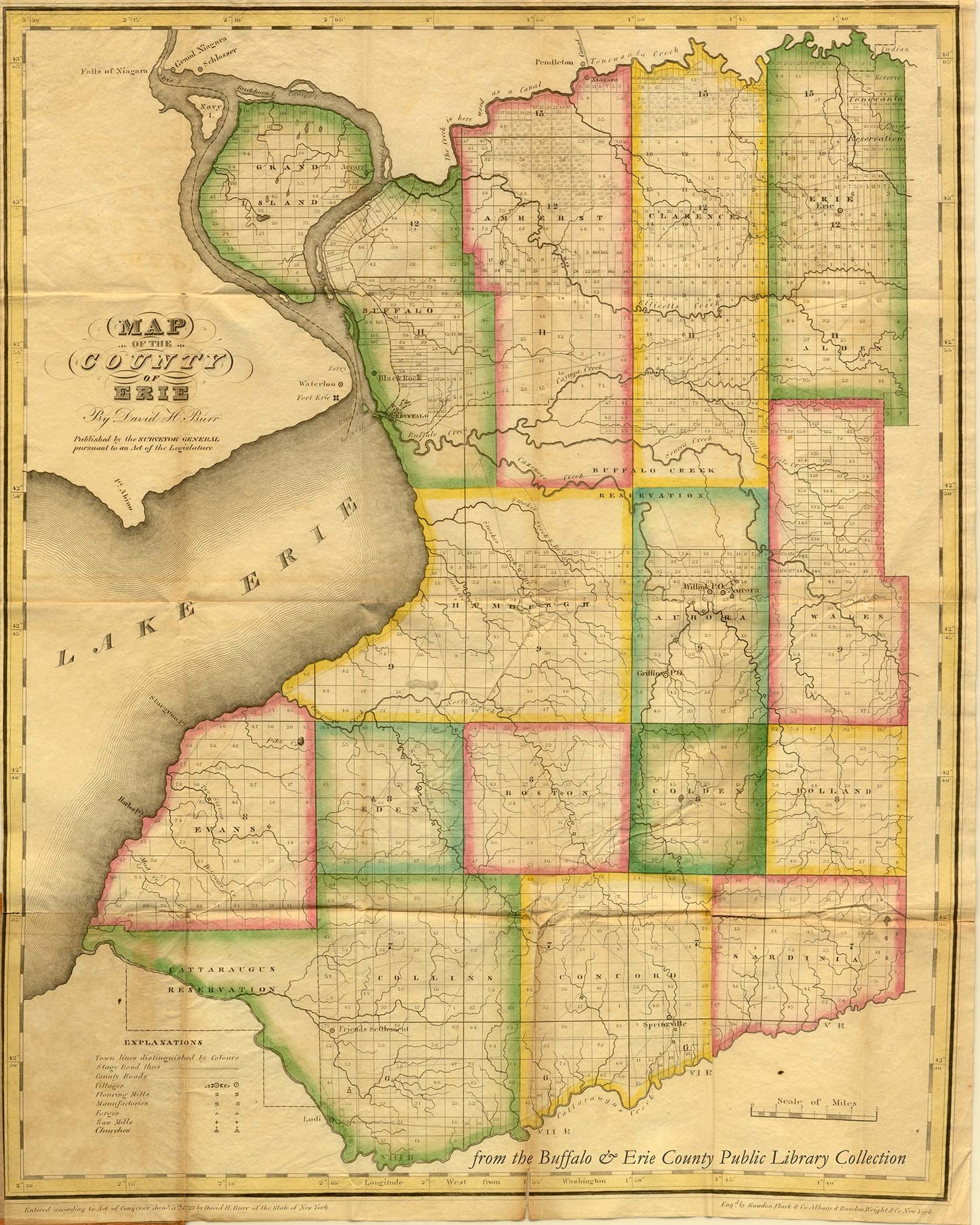
Early Map of Erie County, 1829
Early Map of Erie County, 1829
Regular price
$ 15.95 USD
Regular price
Sale price
$ 15.95 USD
Unit price
per
Couldn't load pickup availability
Showing the early layout of many of the towns still known today, this Erie County map is taken from David Burr’s Atlas of the State of New York, published in 1829, just 8 years after the area was designated as Erie County and 4 years after the completion of the Erie Canal. Burr, an American cartographer and surveyor, was later the official topographer for the U.S. Post Office and Surveyor General of Utah.
Reproduction print on archival paper: image size 8 x 10 inches, matted to 11 x 14 inch size.
All images are produced as quality archival prints. Water- and fade-resistant, we ensure that our prints will provide customer satisfaction for generations to come.